
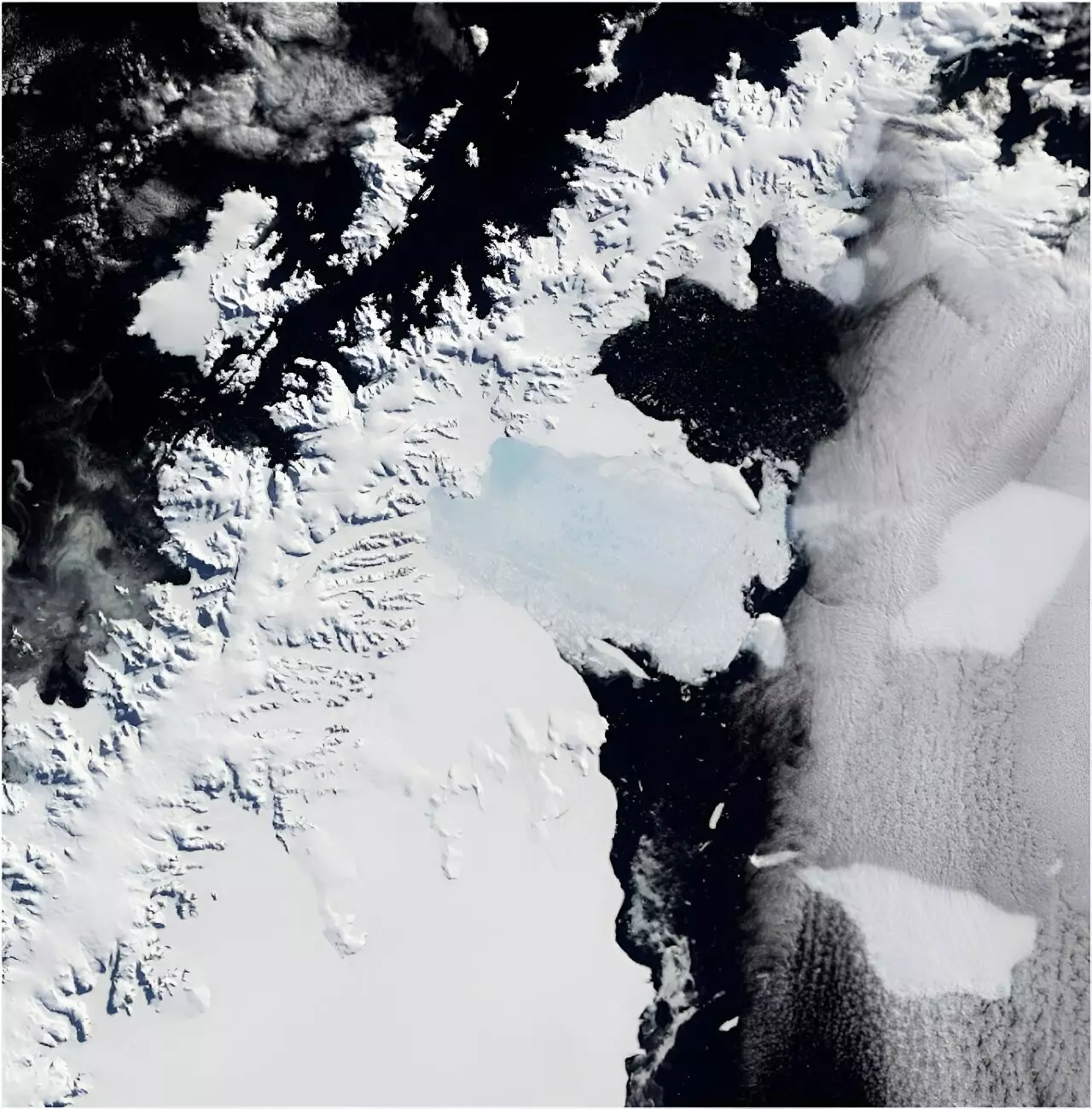
In March 2002, a significant environmental event took place: the Larsen B Ice Shelf collapsed, an event that sent shockwaves through the scientific community. Spanning an area approximately one-sixth the size of Tasmania, the catastrophic fracture of this ice shelf provides vital lessons about climate change and its implications for our planet. Although Antarctica seems distant, the changes originating from this frozen continent have direct consequences for global sea levels, highlighting an urgent issue that demands our attention.
The recent publication in *Scientific Reports* utilizes an innovative approach to understand this event better. Researchers meticulously examined nearly 1,000 film photographs captured in the 1960s to reconstruct the status of five key glaciers prior to the ice shelf’s collapse. This investigation not only elucidates the historical context of these majestic glaciers but also quantifies their contribution to global sea-level rise—an often-overlooked aspect of climate change.
The Hidden Cost of Ice Shelf Loss
To comprehend the gravity of ice shelf loss, it is crucial to understand their role in regulating glacial flow. Ice shelves are massive floating structures that act as barriers, holding back glaciers from flowing directly into the ocean. The removal of these shelves unleashes a torrent of ice, allowing glaciers to pour into the sea at an alarming rate. This process is not merely an environmental concern for Antarctica; it is a burgeoning crisis affecting the rest of the world.
The collapse of the Larsen B Ice Shelf triggered a remarkable transformation of the glacial landscape, with scientists noting a staggering loss of 35 billion tons of land-based ice in just a few years. To illustrate this magnitude, consider that one glacier alone relinquished 28 billion tons, contributing around 0.1 mm to global sea-level rise—an occurrence that, while seemingly small, equates to the entire global population dumping a liter of water each day for a decade. Such analogies paint a clearer picture of how interconnected our world truly is, linking distant ice to our coastal cities.
Challenges in Gathering Reliable Data
Despite the critical need for accurate monitoring in Antarctica, traditional research methods often fall short due to the continent’s remoteness and hostile climate conditions. The persistent cloud cover of the Antarctic Peninsula hampers satellite observations, rendering them less effective for prolonged periods. This limitation leaves scientists in a precarious position: they must grapple with an absence of reliable data to assess glacial changes over time.
Interestingly, the vast repository of historical photographs—over 300,000 captured by U.S. Navy cartographers between 1946 and 2000—becomes a beacon of hope in this data desert. These high-resolution images, archived by the Polar Geospatial Center at the University of Minnesota, are indispensable in reconstructing the historical variances of glaciers. Employing sophisticated photogrammetry techniques, researchers create precise 3D models from these images, providing insight into how glaciers have evolved.
Reconstructing the Past for a Stable Future
By comparing the state of five glaciers in 1968 and again just before the 2002 collapse, researchers discovered that these glaciers appeared stable, with little change noted during that time frame. However, post-collapse observations revealed that their survival was tenuous. Understanding this evolution is paramount as climate change accelerates, forcing scientists to confront an uncertain future for the remaining ice shelves of the Antarctic Peninsula.
What is particularly exciting about this historical archive of photographs is its potential applications beyond documenting glaciers. This unique repository serves as a time machine, capable of illuminating trends in coastlines, shifting vegetation patterns, and even grounding our understanding of local wildlife ecosystems, such as penguin colonies. The repercussions are far-reaching, making it imperative that the global scientific community capitalizes on this invaluable data to develop informed responses to the climate crisis.
A Call to Action for Science and Society
As climate change continues to alter our global landscape, it is essential that policymakers, scientists, and citizens unite to elevate awareness about the issues arising from Antarctica’s ice shelf collapse. By understanding our planet’s past, we can gain insights into mitigating the effects of future climate fluctuations. The lessons learned from the Larsen B Ice Shelf are not merely academic; they are urgent reminders of the precarious balance our ecosystems maintain, and the devastating consequences of inaction.
In this defining moment, the historical image archive represents not just a resource but a clarion call to action—for scientists to pursue groundbreaking research and for the global community to advocate for sustainable solutions that protect our planet’s future. The implications of the collapse extend far beyond distant ice; they reverberate through our oceans, cities, and lives. The time to act is now.